Scunthorpe Ridgeway
Introduction
The photograph on this page of Scunthorpe Ridgeway by Oliver Dixon as part of the Geograph project.
The Geograph project started in 2005 with the aim of publishing, organising and preserving representative images for every square kilometre of Great Britain, Ireland and the Isle of Man.

There are currently over 7.5m images from over 14,400 individuals and you can help contribute to the project by visiting https://www.geograph.org.uk
Scunthorpe Ridgeway
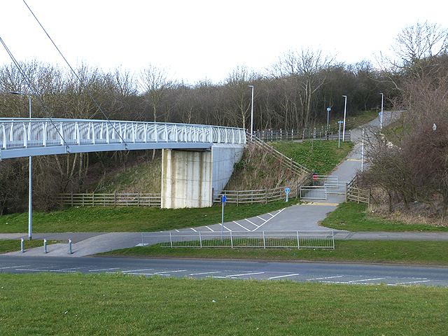
Image: © Oliver Dixon Taken: 10 Mar 2014
The Ridgeway is a traffic-free path which runs north-south through green space for 10 km the length of Scunthorpe. Construction of the path is the realisation of a dream of Sir Patrick Abercombie (1879-1957), the famous planner who once worked in town planning in Scunthorpe. This shows the northern end of a spectacular cable-stay bridge over Westcommon Road and a ramp down to the road.
Images are licensed for reuse under creativecommons.org/licenses/by-sa/2.0
Image Location
Latitude
53.574359
Longitude
-0.671594