Encombe Place
Introduction
The photograph on this page of Encombe Place by David Dixon as part of the Geograph project.
The Geograph project started in 2005 with the aim of publishing, organising and preserving representative images for every square kilometre of Great Britain, Ireland and the Isle of Man.

There are currently over 7.5m images from over 14,400 individuals and you can help contribute to the project by visiting https://www.geograph.org.uk
Encombe Place
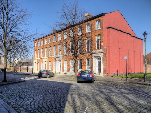
Image: © David Dixon Taken: 11 Mar 2014
The terrace of 4 houses (now in use as offices) on the east side of Encombe Place formed part of a longer terrace, the rest of which has now demolished. The terrace, which dates from the early nineteenth century, is a Grade II Listed Building (English Heritage ID:471553 http://www.britishlistedbuildings.co.uk/en-471553-6-12-encombe-place- British Listed Buildings.) This area around the back of St Philips Church is a fine example of one of the few remaining Georgian areas of the city.
Images are licensed for reuse under creativecommons.org/licenses/by-sa/2.0
Image Location
Latitude
53.484457
Longitude
-2.263077