Chapel Ash, Wolverhampton
Introduction
The photograph on this page of Chapel Ash, Wolverhampton by Roger D Kidd as part of the Geograph project.
The Geograph project started in 2005 with the aim of publishing, organising and preserving representative images for every square kilometre of Great Britain, Ireland and the Isle of Man.

There are currently over 7.5m images from over 14,400 individuals and you can help contribute to the project by visiting https://www.geograph.org.uk
Chapel Ash, Wolverhampton
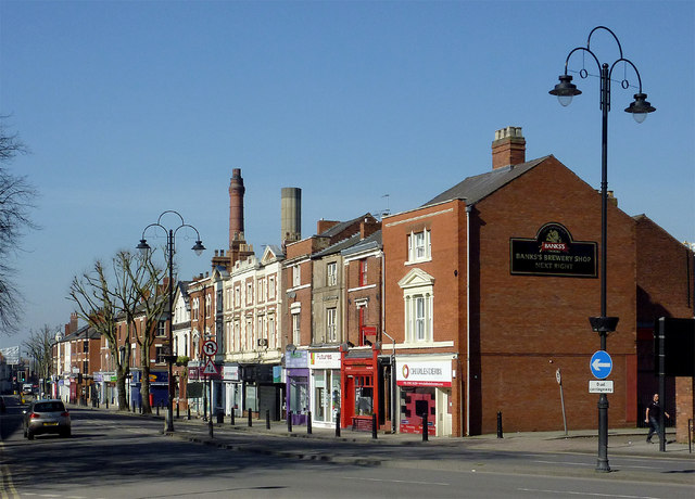
Image: © Roger D Kidd Taken: 9 Mar 2014
Chapel Ash is the A41 (and A454) leading out of the city centre. The chimneys of Banks's (now trading as Marston's) Brewery can be seen above the roof tops.
Images are licensed for reuse under creativecommons.org/licenses/by-sa/2.0
Image Location
Latitude
52.584767
Longitude
-2.137365