Former Salford Town Hall, Bexley Square
Introduction
The photograph on this page of Former Salford Town Hall, Bexley Square by David Dixon as part of the Geograph project.
The Geograph project started in 2005 with the aim of publishing, organising and preserving representative images for every square kilometre of Great Britain, Ireland and the Isle of Man.

There are currently over 7.5m images from over 14,400 individuals and you can help contribute to the project by visiting https://www.geograph.org.uk
Former Salford Town Hall, Bexley Square
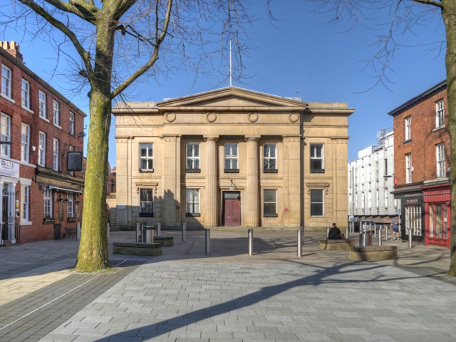
Image: © David Dixon Taken: 11 Mar 2014
The old Salford Town Hall, which was built between 1825 and 1827, sits at the far end of Bexley Square, just off Chapel Street. It is a Grade II listed building (English Heritage ID:471500 http://www.britishlistedbuildings.co.uk/en-471500-town-hall- British Listed Buildings). Detail from an 1849 map http://manchesterhistory.net/manchester/outside/salfordThall.html shows that the building was not only home to the business of the Town Hall but also included a police station, fire station and a court house. Today the business of the City of Salford is conducted at Image The tree-lined square gained notoriety in 1931 when it was the scene of the infamous ‘Battle of Bexley Square’. This was the fight against the government-enforced means test and poverty in Salford, which went on to feature in Walter Greenwood’s play ‘Love on The Dole’ (Image]). http://manchesterhistory.net/manchester/outside/salfordThall.html Manchester History Net http://www.visitsalford.info/documents/chapelstreettrail.pdf Chapel Street Heritage Trail
Images are licensed for reuse under creativecommons.org/licenses/by-sa/2.0
Image Location
Latitude
53.483747
Longitude
-2.259155