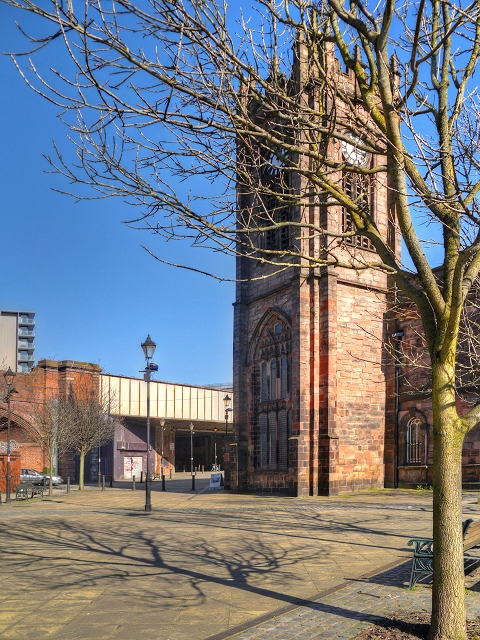
Sacred Trinity Church and the former site of the Flat Iron Market in Salford
Introduction
The photograph on this page of Sacred Trinity Church and the former site of the Flat Iron Market in Salford by David Dixon as part of the Geograph project.
The Geograph project started in 2005 with the aim of publishing, organising and preserving representative images for every square kilometre of Great Britain, Ireland and the Isle of Man.
There are currently over 7.5m images from over 14,400 individuals and you can help contribute to the project by visiting https://www.geograph.org.uk

Image: © David Dixon Taken: 11 Mar 2014
The Flat Iron conservation area is centred on the Grade II * listed Image] on Chapel Street, close to the boundary with the city of Manchester. It gets its name from the triangular shaped plot of land which contained both Trinity Church and the market itself, resembling the shape of flat, hot coal-heated iron once used for ironing clothes. WS Lowry painted the view of Trinity and the Flat Iron from Chapel Street in 1925 and it is now one of the few views in the city that has remained relatively unchanged since he painted it. http://www.flickr.com/photos/manchesterarchiveplus/6045282239/ photo of Flat Iron Market in 1894 (Manchester Archives) http://www.visitsalford.info/documents/chapelstreettrail.pdf Chapel Street Heritage Trail http://www.britishlistedbuildings.co.uk/en-471610-church-of-the-sacred-trinity- Church of the Sacred Trinity, Salford (British Listed Buildings)

