School Lane, Uppingham
Introduction
The photograph on this page of School Lane, Uppingham by Oliver Dixon as part of the Geograph project.
The Geograph project started in 2005 with the aim of publishing, organising and preserving representative images for every square kilometre of Great Britain, Ireland and the Isle of Man.

There are currently over 7.5m images from over 14,400 individuals and you can help contribute to the project by visiting https://www.geograph.org.uk
School Lane, Uppingham
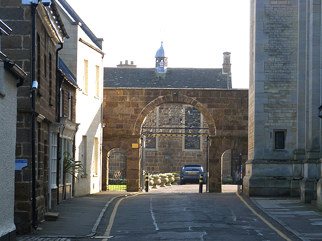
Image: © Oliver Dixon Taken: 9 Mar 2014
Off High Street West, School Lane leads into the heart of the buildings of the famous public school. Through the archway is the Library, one of the oldest of the school buildings, dating to 1593, with the Memorial Hall to the right.
Images are licensed for reuse under creativecommons.org/licenses/by-sa/2.0
Image Location
Latitude
52.587776
Longitude
-0.724058