Blackfriars House
Introduction
The photograph on this page of Blackfriars House by David Dixon as part of the Geograph project.
The Geograph project started in 2005 with the aim of publishing, organising and preserving representative images for every square kilometre of Great Britain, Ireland and the Isle of Man.

There are currently over 7.5m images from over 14,400 individuals and you can help contribute to the project by visiting https://www.geograph.org.uk
Blackfriars House
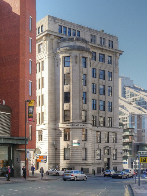
Image: © David Dixon Taken: 11 Mar 2014
Blackfriars House sits on the bank of the River Irwell at the corner of Blackfriars Road and St. Mary's Parsonage. It was built in 1923 for the Bleachers' Association. Today the building is leased as office space by the property company Bruntwood.
Images are licensed for reuse under creativecommons.org/licenses/by-sa/2.0
Image Location
Latitude
53.483501
Longitude
-2.2477