Bradley Street, Manchester
Introduction
The photograph on this page of Bradley Street, Manchester by Tricia Neal as part of the Geograph project.
The Geograph project started in 2005 with the aim of publishing, organising and preserving representative images for every square kilometre of Great Britain, Ireland and the Isle of Man.

There are currently over 7.5m images from over 14,400 individuals and you can help contribute to the project by visiting https://www.geograph.org.uk
Bradley Street, Manchester
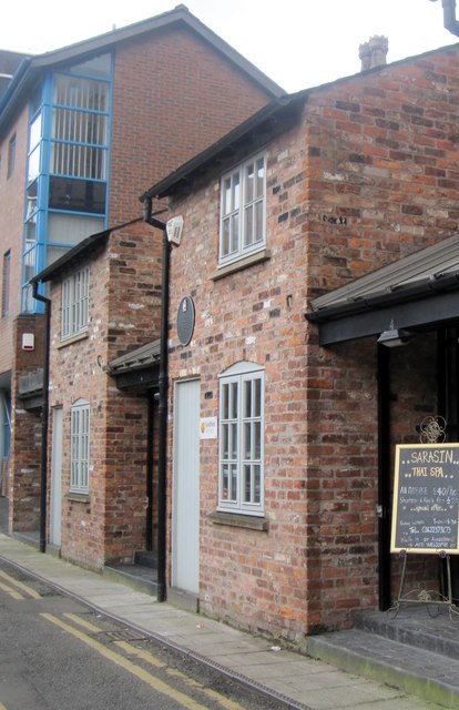
Image: © Tricia Neal Taken: 28 Feb 2014
Bradley Street is in the Northern Quarter. The black plaque on these buildings says: "4, 6 and 8 Bradley Street: Two "one-up one-down" houses in each of these three outriggers to the rear of the grander properties on Lever Street were built in 1787. Although rebuilt and altered in 1996, they represent the last surviving examples of this type of accommodation in the City. Records indicate as many as 12 people living in one property."
Images are licensed for reuse under creativecommons.org/licenses/by-sa/2.0
Image Location
Latitude
53.483711
Longitude
-2.232783