Glyn Padarn
Introduction
The photograph on this page of Glyn Padarn by Ian Capper as part of the Geograph project.
The Geograph project started in 2005 with the aim of publishing, organising and preserving representative images for every square kilometre of Great Britain, Ireland and the Isle of Man.

There are currently over 7.5m images from over 14,400 individuals and you can help contribute to the project by visiting https://www.geograph.org.uk
Glyn Padarn
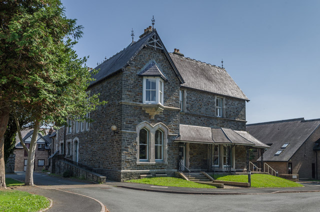
Image: © Ian Capper Taken: 26 Aug 2013
Late Victorian villa converted as part of a retirement/sheltered housing development in 1991. Grade II listed - see http://cadwpublic-api.azurewebsites.net/reports/listedbuilding/FullReport?lang=en&id=27053.
Images are licensed for reuse under creativecommons.org/licenses/by-sa/2.0
Image Location


Leaflet Map data © OpenStreetMap
Latitude
52.407975
Longitude
-4.061847