Victoria Street, Wolverhampton
Introduction
The photograph on this page of Victoria Street, Wolverhampton by Roger D Kidd as part of the Geograph project.
The Geograph project started in 2005 with the aim of publishing, organising and preserving representative images for every square kilometre of Great Britain, Ireland and the Isle of Man.

There are currently over 7.5m images from over 14,400 individuals and you can help contribute to the project by visiting https://www.geograph.org.uk
Victoria Street, Wolverhampton
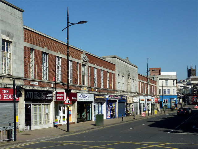
Image: © Roger D Kidd Taken: 9 Mar 2014
Looking towards St Peter's Church (on the skyline) from the crossroads at Cleveland Street. This is a deceptively "normal" city centre scene; the other side of the road has many derelict Victorian retail properties, victims of failed city regeneration projects during the last twenty years. The other side of the road in 2012: http://www.geograph.org.uk/photo/2835989 It has not improved in the last two years!
Images are licensed for reuse under creativecommons.org/licenses/by-sa/2.0
Image Location
Latitude
52.583696
Longitude
-2.130277