Storm water holding tank construction site, Station Approach, Royal Leamington Spa
Introduction
The photograph on this page of Storm water holding tank construction site, Station Approach, Royal Leamington Spa by Robin Stott as part of the Geograph project.
The Geograph project started in 2005 with the aim of publishing, organising and preserving representative images for every square kilometre of Great Britain, Ireland and the Isle of Man.

There are currently over 7.5m images from over 14,400 individuals and you can help contribute to the project by visiting https://www.geograph.org.uk
Storm water holding tank construction site, Station Approach, Royal Leamington Spa
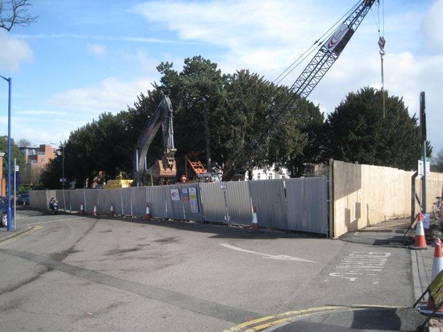
Image: © Robin Stott Taken: 11 Mar 2013
A key installation in the multimillion pound scheme to replace and enlarge sewers in south Leamington. The site is at the eastern end of Station Approach. The yew trees beyond once lined the Upper Avenue – one of a pair of drives to the Manor House, the other drive being the modern Lower Avenue. For many years a hotel, the Manor House has been redeveloped and extended as flats, just visible, left. Update November 2013: the finished result – all that's outwardly visible: http://www.geograph.org.uk/p/3887752
Images are licensed for reuse under creativecommons.org/licenses/by-sa/2.0
Image Location


Leaflet Map data © OpenStreetMap
Latitude
52.285381
Longitude
-1.536714