"The Final Whistle", Southwell
Introduction
The photograph on this page of "The Final Whistle", Southwell by Oliver Dixon as part of the Geograph project.
The Geograph project started in 2005 with the aim of publishing, organising and preserving representative images for every square kilometre of Great Britain, Ireland and the Isle of Man.

There are currently over 7.5m images from over 14,400 individuals and you can help contribute to the project by visiting https://www.geograph.org.uk
"The Final Whistle", Southwell
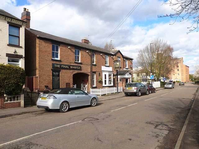
Image: © Oliver Dixon Taken: 7 Mar 2014
The sign outside reads: "Adjacent to where you stand today lies a disused railway line which linked the town of Southwell to the Midland railway network, this short branch line started at Rolleston junction which opened on 1st July 1847 carrying grain to Caudwell Mill, Livestock and Coal. Steam locomotives were used from 1860 for passenger services stopping at stations in Kirklington, Farnsfield and Rainworth, Passenger numbers dwindled during the 1950's and despite running a little 'pull and push' train consisting of one engine and one coach nicknamed the "Paddy", the Southwell-Rolleston line was closed to passengers on the 16th June 1959 though the National Coal Board still used it until 1968. Many railways were closed during this time, and the era was known as "The Final Whistle" which is where the name of the pub derives from. In 1969 the track was lifted and Notts County Council bought the disused line and designated the section from Southwell to Farnsfield a public footpath. This route is now a well-loved nature trail and "The Final Whistle" opens its doors once again to serve the local community and its visitors as it did before the final whistle was blown in 1968. We hope you enjoy your visit".
Images are licensed for reuse under creativecommons.org/licenses/by-sa/2.0
Image Location
Latitude
53.081803
Longitude
-0.947326