Old Corn Mill
Introduction
The photograph on this page of Old Corn Mill by jeff collins as part of the Geograph project.
The Geograph project started in 2005 with the aim of publishing, organising and preserving representative images for every square kilometre of Great Britain, Ireland and the Isle of Man.

There are currently over 7.5m images from over 14,400 individuals and you can help contribute to the project by visiting https://www.geograph.org.uk
Old Corn Mill
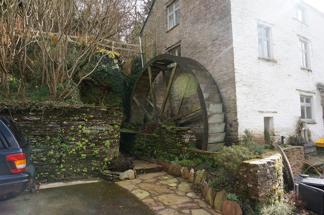
Image: © jeff collins Taken: 5 Mar 2014
As far as I know this old building used to be the Deerbridge Corn Mill, on an old map of 1889 that's what it is known as. It is close to Watergate and under a mile from Deerbridge. It would be nice to see exactly how old it is. Now it seems to have been divided into a couple of houses.
Images are licensed for reuse under creativecommons.org/licenses/by-sa/2.0
Image Location
Latitude
50.291485
Longitude
-3.671782