
Old hedge line and footpath
Introduction
The photograph on this page of Old hedge line and footpath by Richard Dorrell as part of the Geograph project.
The Geograph project started in 2005 with the aim of publishing, organising and preserving representative images for every square kilometre of Great Britain, Ireland and the Isle of Man.

There are currently over 7.5m images from over 14,400 individuals and you can help contribute to the project by visiting https://www.geograph.org.uk
Old hedge line and footpath
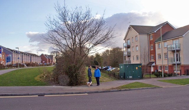
Image: © Richard Dorrell Taken: 1 Mar 2014
The road on the left is Lebburn Meadows, viewed from White's Way. A hedge and unsurfaced footpath (behind the dog-walkers) look slightly out of place amid the recently built housing in Dowd's Farm. The hedge and path are relics from before the housing was developed - there always was a footpath here, and it has been retained. An underground gas main also follows the line of the path. The green box-type shed (photographed) contains gas valves or a pump of some kind. A hissing noise emanates from within.
Images are licensed for reuse under creativecommons.org/licenses/by-sa/2.0
Image Location

Latitude
50.92843
Longitude
-1.306002