Sacred Trinity Church, Salford
Introduction
The photograph on this page of Sacred Trinity Church, Salford by David Dixon as part of the Geograph project.
The Geograph project started in 2005 with the aim of publishing, organising and preserving representative images for every square kilometre of Great Britain, Ireland and the Isle of Man.

There are currently over 7.5m images from over 14,400 individuals and you can help contribute to the project by visiting https://www.geograph.org.uk
Sacred Trinity Church, Salford
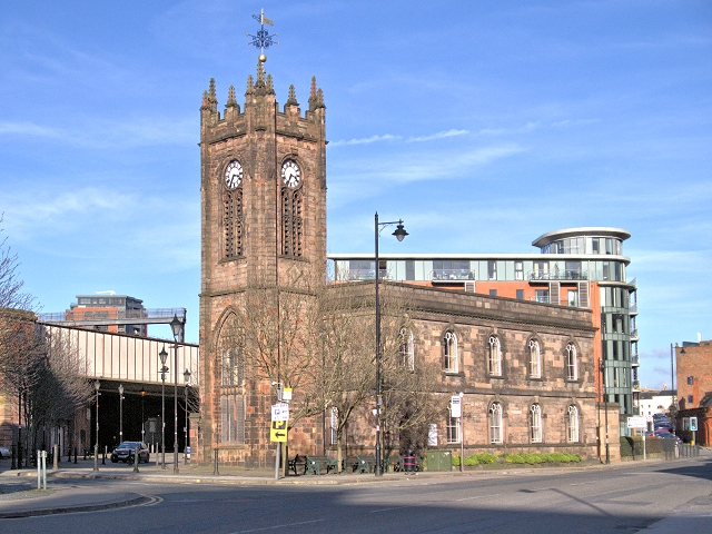
Image: © David Dixon Taken: 3 Mar 2014
Sacred Trinity is on the junction of Chapel St and Blackfriars Rd, very close to Manchester City Centre. Originally known as “Chapel”, Sacred Trinity is Salford’s oldest church and gave the street its name. Prior to this, the street was actually called Sergeant Street. Trinity Church dates from 1635, it was originally built as a chapel-of-ease to serve the growing population of Salford. Most of the current building dates from 1752. It is a grade II listed building with many original features (English heritage ID:471610 http://www.britishlistedbuildings.co.uk/en-471610-church-of-the-sacred-trinity- British Listed Buildings). It was restored in 1877-74 and adapted for more flexible use in the 1980s. http://www.salfordchurch.org/Sacred_Trinity.html Salford Churches http://www.visitsalford.info/documents/chapelstreettrail.pdf Chapel Street Heritage Trail
Images are licensed for reuse under creativecommons.org/licenses/by-sa/2.0
Image Location
Latitude
53.484753
Longitude
-2.250722