Otley weir and Garnett's paper mill
Introduction
The photograph on this page of Otley weir and Garnett's paper mill by John Winder as part of the Geograph project.
The Geograph project started in 2005 with the aim of publishing, organising and preserving representative images for every square kilometre of Great Britain, Ireland and the Isle of Man.

There are currently over 7.5m images from over 14,400 individuals and you can help contribute to the project by visiting https://www.geograph.org.uk
Otley weir and Garnett's paper mill
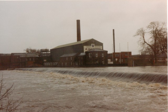
Image: © John Winder Taken: Unknown
Taken when the mill was still active in late 1992 (I think). The river is a good bit higher than usual: see John Sparshatt's photo at http://www.geograph.org.uk/photo/3265333 for how it usually looks. When I was a kid, I and my brother and sister used to come and play in the river here, treating the weir like a big waterslide. I imagine social services would be called if you let your kids do such a thing these days! Garnett's mill is now closed and the area is having hundreds of houses built on it.
Images are licensed for reuse under creativecommons.org/licenses/by-sa/2.0
Image Location


Leaflet Map data © OpenStreetMap
Latitude
53.910028
Longitude
-1.691406