Bell Dean
Introduction
The photograph on this page of Bell Dean by David Spencer as part of the Geograph project.
The Geograph project started in 2005 with the aim of publishing, organising and preserving representative images for every square kilometre of Great Britain, Ireland and the Isle of Man.

There are currently over 7.5m images from over 14,400 individuals and you can help contribute to the project by visiting https://www.geograph.org.uk
Bell Dean
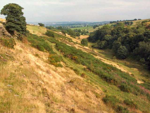
Image: © David Spencer Taken: 16 Aug 2005
This is a narrow, steep valley with tiny Pitty Beck in the bottom. The inadequacy of the modern stream to produce such a valley indicates that the valley was probably formed by glacial meltwater at the end of the last ice age.
Images are licensed for reuse under creativecommons.org/licenses/by-sa/2.0
Image Location


Leaflet Map data © OpenStreetMap
Latitude
53.800418
Longitude
-1.857246