Former trolleybus turning circle, Thornton Road
Introduction
The photograph on this page of Former trolleybus turning circle, Thornton Road by David Spencer as part of the Geograph project.
The Geograph project started in 2005 with the aim of publishing, organising and preserving representative images for every square kilometre of Great Britain, Ireland and the Isle of Man.

There are currently over 7.5m images from over 14,400 individuals and you can help contribute to the project by visiting https://www.geograph.org.uk
Former trolleybus turning circle, Thornton Road
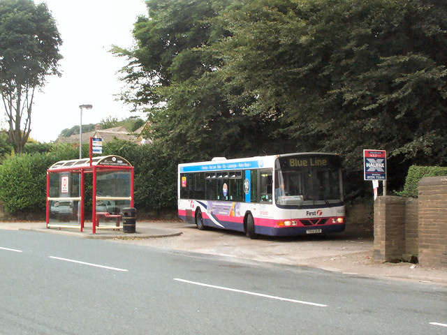
Image: © David Spencer Taken: 16 Aug 2005
Close by the Cemetery entrance, and still in use as a bus terminus, though the number 7 double deck trolleybus has given way to the number 607 'blue line' single deck motorbus.
Images are licensed for reuse under creativecommons.org/licenses/by-sa/2.0
Image Location


Leaflet Map data © OpenStreetMap
Latitude
53.791444
Longitude
-1.869845