The Ballygowan Road, Castlereagh/Belfast
Introduction
The photograph on this page of The Ballygowan Road, Castlereagh/Belfast by Albert Bridge as part of the Geograph project.
The Geograph project started in 2005 with the aim of publishing, organising and preserving representative images for every square kilometre of Great Britain, Ireland and the Isle of Man.

There are currently over 7.5m images from over 14,400 individuals and you can help contribute to the project by visiting https://www.geograph.org.uk
The Ballygowan Road, Castlereagh/Belfast
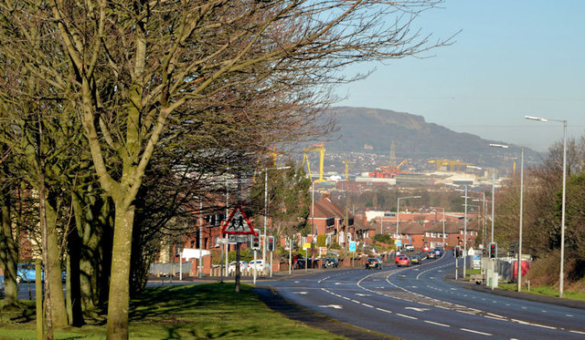
Image: © Albert Bridge Taken: 3 Mar 2014
The road from Ballygowan, at a height of about 300ft, making a steep drop towards the Castlereagh Road and the centre of Belfast. The Church Road traffic lights are at lower right.
Images are licensed for reuse under creativecommons.org/licenses/by-sa/2.0
Image Location
Latitude
54.574858
Longitude
-5.867955