Lowdham, Notts.
Introduction
The photograph on this page of Lowdham, Notts. by David Hallam-Jones as part of the Geograph project.
The Geograph project started in 2005 with the aim of publishing, organising and preserving representative images for every square kilometre of Great Britain, Ireland and the Isle of Man.

There are currently over 7.5m images from over 14,400 individuals and you can help contribute to the project by visiting https://www.geograph.org.uk
Lowdham, Notts.
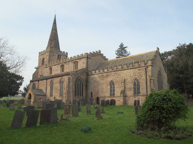
Image: © David Hallam-Jones Taken: 28 Feb 2014
The south and south-easterly facing elevations of the Parish Church of St Mary-the-Virgin, Church Lane. This Grade I-listed building is situated in a hollow on the west side of the village, the village having being bisected just before WWII by the dual carriageway Epperstone By-Pass (the A6097). According to the Rev. A.M.Y. Baylay (in 1908) the oldest part of this church is its late C12th (or early 13th) stone tower, which may well have stood clear of the original medieval church that was probably of timber. The whole of the tower is said to be of one date with the spire being a later addition dating from the C14th or C15th. The church itself evolved through C13th, C14th and C15th and was restored in 1860. The spire it seems was substantially repaired in 1883 and the chancel was restored in 1890. A road bridge, a stone's throw away behind the photographer, carries Church Lane over Cocker Beck as the latter makes its way through this dell from west to east.
Images are licensed for reuse under creativecommons.org/licenses/by-sa/2.0
Image Location
Latitude
53.014499
Longitude
-1.013358