
Tour de France 2014 Route - Jenkin Road, Wincobank, Sheffield - 1
Introduction
The photograph on this page of Tour de France 2014 Route - Jenkin Road, Wincobank, Sheffield - 1 by Terry Robinson as part of the Geograph project.
The Geograph project started in 2005 with the aim of publishing, organising and preserving representative images for every square kilometre of Great Britain, Ireland and the Isle of Man.

There are currently over 7.5m images from over 14,400 individuals and you can help contribute to the project by visiting https://www.geograph.org.uk
Tour de France 2014 Route - Jenkin Road, Wincobank, Sheffield - 1
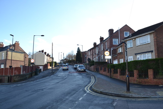
Image: © Terry Robinson Taken: 4 Feb 2014
This view shows the start of the final major hill on Stage 2 of the Tour de France 2014. It will officially be known as the Cote de Jenkin Road … unofficially it is known as 'the steepest road in Sheffield' or perhaps there will be a few four lettered expletives added somewhere. I have seen its gradient described as being 33.3% … and up to 58% … whichever being only a few miles from the finish it will probably sort out the main GC riders from the rest. Others in Sheffield will debate which is actually the steepest road in Sheffield … but as the other contenders are not on the Tour de France Route … perhaps, for a few months, we should discount them. UPDATE IN JUNE 2014 The finalised route has now been published and the riders will be ascending Jenkin Road from the 'City End' and not as shown here ... See picture 2 in this series. For more views of this site … see … Image Image For other views of Tour de France 2014 route …see … Image Image Image Image Image Image … and follow the links from … Image … and for a view of a couple of steep hill contenders … see … Image Image
Images are licensed for reuse under creativecommons.org/licenses/by-sa/2.0
Image Location

Latitude
53.417148
Longitude
-1.431077