The Jolly Ostler at Shoreham
Introduction
The photograph on this page of The Jolly Ostler at Shoreham by Marathon as part of the Geograph project.
The Geograph project started in 2005 with the aim of publishing, organising and preserving representative images for every square kilometre of Great Britain, Ireland and the Isle of Man.

There are currently over 7.5m images from over 14,400 individuals and you can help contribute to the project by visiting https://www.geograph.org.uk
The Jolly Ostler at Shoreham
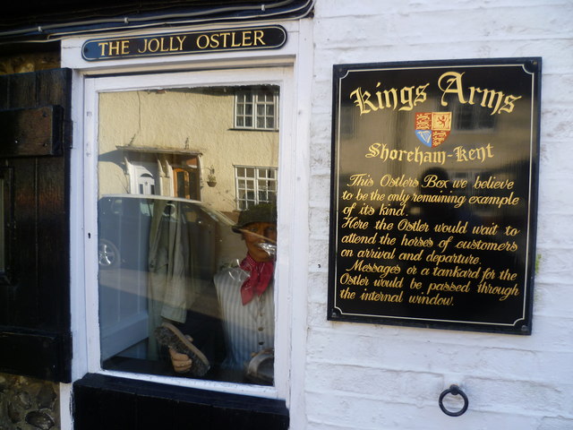
Image: © Marathon Taken: 21 Feb 2014
Part of the Kings Arms, the explanation of the Jolly Ostler is here. Facing out on to Church Street this is difficult to photograph because of the reflection. See also http://www.geograph.org.uk/photo/3865732
Images are licensed for reuse under creativecommons.org/licenses/by-sa/2.0
Image Location


Leaflet Map data © OpenStreetMap
Latitude
51.33336
Longitude
0.180661