Donegall Quay, Belfast (May 1990)
Introduction
The photograph on this page of Donegall Quay, Belfast (May 1990) by Albert Bridge as part of the Geograph project.
The Geograph project started in 2005 with the aim of publishing, organising and preserving representative images for every square kilometre of Great Britain, Ireland and the Isle of Man.

There are currently over 7.5m images from over 14,400 individuals and you can help contribute to the project by visiting https://www.geograph.org.uk
Donegall Quay, Belfast (May 1990)
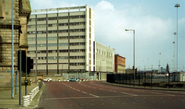
Image: © Albert Bridge Taken: 13 May 1990
I took this with an eye on the future knowing that the scene would change with the building of the cross-harbour road and railway http://www.geograph.org.uk/snippet/5008. The red building (middle/right) was Thompson’s feed mill Image The road and railway now pass through its site. Tomb Street sorting office Image (middle/left) was later the subject of a major recladding. The “Obel” Image now occupies the site (right) of the ferry terminal http://www.geograph.org.uk/snippet/3872 where work is now underway on the construction of a new office block. The Custom House (left) remains, unchanged. For comparison see Image
Images are licensed for reuse under creativecommons.org/licenses/by-sa/2.0
Image Location
Latitude
54.602401
Longitude
-5.922386