An island next to Thames Ditton Island
Introduction
The photograph on this page of An island next to Thames Ditton Island by Marathon as part of the Geograph project.
The Geograph project started in 2005 with the aim of publishing, organising and preserving representative images for every square kilometre of Great Britain, Ireland and the Isle of Man.

There are currently over 7.5m images from over 14,400 individuals and you can help contribute to the project by visiting https://www.geograph.org.uk
An island next to Thames Ditton Island
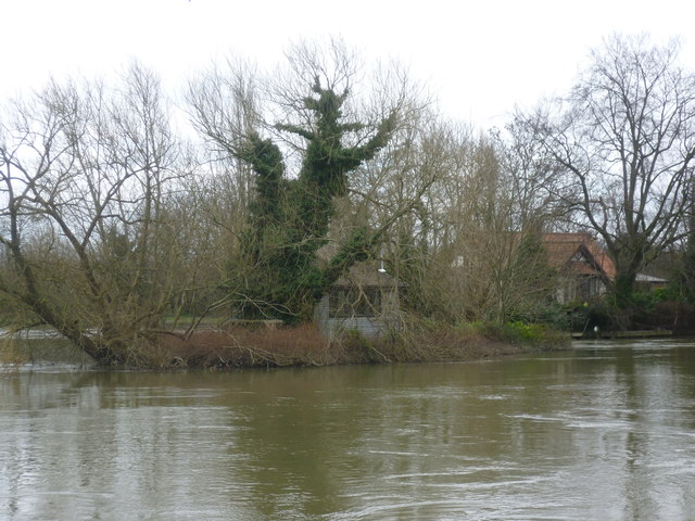
Image: © Marathon Taken: 19 Feb 2014
Seen from near the suspension bridge to Thames Ditton Island, this small island is a few yards downstream. After the wettest winter on record and extensive flooding by the Thames the river was exceptionally high and fast-flowing. It seemed that many of the properties on the islands were flooded and on the mainland sandbags were to be seen everywhere.
Images are licensed for reuse under creativecommons.org/licenses/by-sa/2.0
Image Location
Latitude
51.392742
Longitude
-0.329965