Kersal Bar Toll House, Kersal, Salford
Introduction
The photograph on this page of Kersal Bar Toll House, Kersal, Salford by Tricia Neal as part of the Geograph project.
The Geograph project started in 2005 with the aim of publishing, organising and preserving representative images for every square kilometre of Great Britain, Ireland and the Isle of Man.

There are currently over 7.5m images from over 14,400 individuals and you can help contribute to the project by visiting https://www.geograph.org.uk
Kersal Bar Toll House, Kersal, Salford
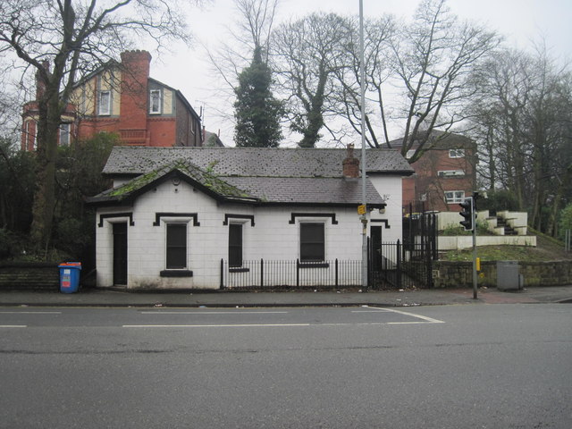
Image: © Tricia Neal Taken: 19 Feb 2014
This view was taken from the opposite side of Bury New Road. The two-storey addition along the back must have been added after the building was listed, as the description there says: "Former toll house, latterly in use as shop, but now disused. Early C19. Stucco over brick with slate roof felted over, and stack on right hand side. Single-storey, octagonal single-unit plan with additional rectangular bay to right. Entrance to left, windows in gable facing street and to right, both replaced but with original drop-ended hoodmoulds over. Probably the only surviving toll house in the Manchester and Salford area."
Images are licensed for reuse under creativecommons.org/licenses/by-sa/2.0
Image Location
Latitude
53.514824
Longitude
-2.269147