Kynance Place
Introduction
The photograph on this page of Kynance Place by Roger Jones as part of the Geograph project.
The Geograph project started in 2005 with the aim of publishing, organising and preserving representative images for every square kilometre of Great Britain, Ireland and the Isle of Man.

There are currently over 7.5m images from over 14,400 individuals and you can help contribute to the project by visiting https://www.geograph.org.uk
Kynance Place
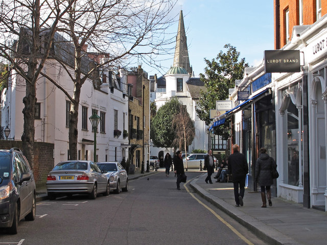
Image: © Roger Jones Taken: 22 Feb 2014
Running west from Gloucester Road, to the north of Kynance Mews, with Christ Church http://www.christchurchkensington.com/ steeple in the background. Note the white range of buildings (7-10 Kynance Place) on the left which has widening walls to match the diverging street pattern of Kynance Place and Kynance Mews. For a view of the white buildings from inside Kynance Mews see Image
Images are licensed for reuse under creativecommons.org/licenses/by-sa/2.0
Image Location
Latitude
51.497408
Longitude
-0.184379