Alfred Square
Introduction
The photograph on this page of Alfred Square by Ian Capper as part of the Geograph project.
The Geograph project started in 2005 with the aim of publishing, organising and preserving representative images for every square kilometre of Great Britain, Ireland and the Isle of Man.

There are currently over 7.5m images from over 14,400 individuals and you can help contribute to the project by visiting https://www.geograph.org.uk
Alfred Square
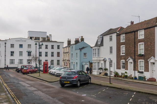
Image: © Ian Capper Taken: 25 Jan 2014
In the background is Lloyd Court, built in 1901 and formerly Deal College, before being converted in 1911 to a convalescent home for members of the printing profession. The two brick faced buildings on the right and the two parts of the white building next to them date from the 19th century and are all grade II listed - from right to left: Nos 5 & 6 - see www.historicengland.org.uk/listing/the-list/list-entry/1069900 No 4 - see www.historicengland.org.uk/listing/the-list/list-entry/1363443 No 3 - see www.historicengland.org.uk/listing/the-list/list-entry/1069900 The K6 telephone box is also grade II listed - see www.historicengland.org.uk/listing/the-list/list-entry/1254065.
Images are licensed for reuse under creativecommons.org/licenses/by-sa/2.0
Image Location
Latitude
51.229198
Longitude
1.402782