Middle Street
Introduction
The photograph on this page of Middle Street by Ian Capper as part of the Geograph project.
The Geograph project started in 2005 with the aim of publishing, organising and preserving representative images for every square kilometre of Great Britain, Ireland and the Isle of Man.

There are currently over 7.5m images from over 14,400 individuals and you can help contribute to the project by visiting https://www.geograph.org.uk
Middle Street
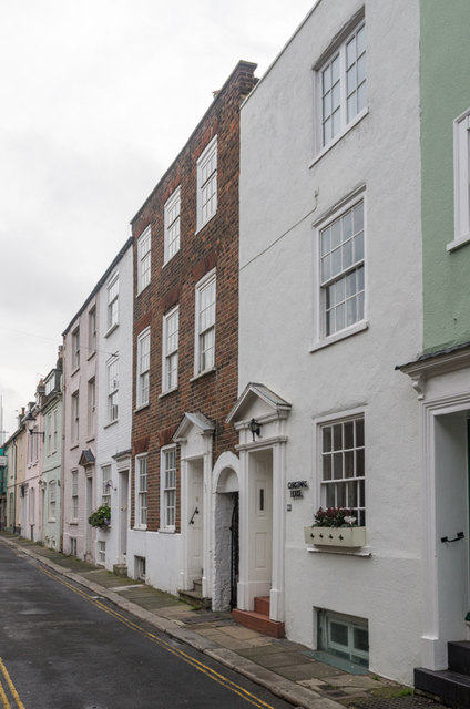
Image: © Ian Capper Taken: 25 Jan 2014
Narrow street running north/south in the area between Beach Street and High Street. Most of these houses are grade II listed, including for example the white building on the right of the photo, no 179, and the brick faced building beyond, no 177, both dating from the early 19th century - see www.historicengland.org.uk/listing/the-list/list-entry/1253825 and www.historicengland.org.uk/listing/the-list/list-entry/1363473 respectively.
Images are licensed for reuse under creativecommons.org/licenses/by-sa/2.0
Image Location
Latitude
51.228794
Longitude
1.403383