Site of former Copperas Hill station
Introduction
The photograph on this page of Site of former Copperas Hill station by Ben Brooksbank as part of the Geograph project.
The Geograph project started in 2005 with the aim of publishing, organising and preserving representative images for every square kilometre of Great Britain, Ireland and the Isle of Man.

There are currently over 7.5m images from over 14,400 individuals and you can help contribute to the project by visiting https://www.geograph.org.uk
Site of former Copperas Hill station
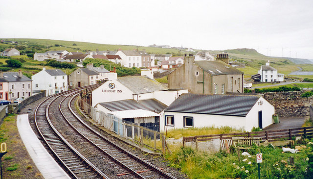
Image: © Ben Brooksbank Taken: 2 Jul 2002
View southward from Harrington station, to Copperas Hill on the ex-Cleator & Workington Junction light railway branch from Harrington Junction to Lowca - as steep as 1-in-17, closed to passengers 1/2/29, to freight much later. Nothing whatever of this Lowca branch is in fact visible, but merely the ex-LNWR (Carlisle) - Maryport - Workington - Whitehaven (Coast) line going south from Harrington station, below the hills showing scars of the former industrial landscape.
Images are licensed for reuse under creativecommons.org/licenses/by-sa/2.0
Image Location
Latitude
54.606947
Longitude
-3.567044