Ideford church
Introduction
The photograph on this page of Ideford church by David Smith as part of the Geograph project.
The Geograph project started in 2005 with the aim of publishing, organising and preserving representative images for every square kilometre of Great Britain, Ireland and the Isle of Man.

There are currently over 7.5m images from over 14,400 individuals and you can help contribute to the project by visiting https://www.geograph.org.uk
Ideford church
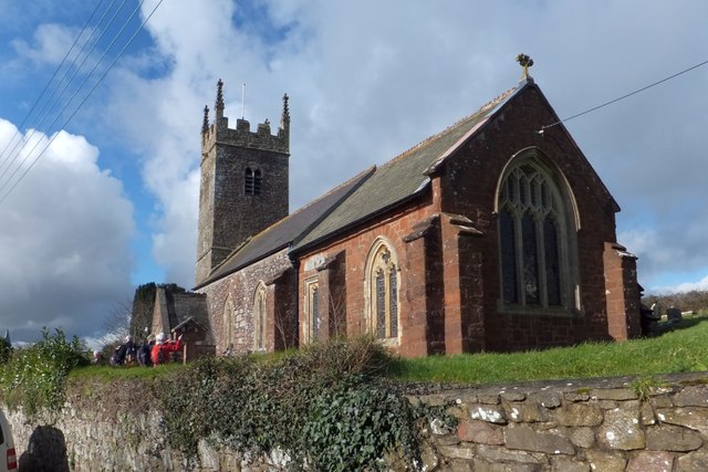
Image: © David Smith Taken: 18 Feb 2014
The church of St Mary. There is a clear difference between the stone used for the walls of nave and chancel. The people are looking at the 12th century tympanum, which has been incorporated into the chancel wall
Images are licensed for reuse under creativecommons.org/licenses/by-sa/2.0
Image Location
Latitude
50.58583
Longitude
-3.563383