Bugby chapel and burial ground, Prospect Place
Introduction
The photograph on this page of Bugby chapel and burial ground, Prospect Place by Hugh Craddock as part of the Geograph project.
The Geograph project started in 2005 with the aim of publishing, organising and preserving representative images for every square kilometre of Great Britain, Ireland and the Isle of Man.

There are currently over 7.5m images from over 14,400 individuals and you can help contribute to the project by visiting https://www.geograph.org.uk
Bugby chapel and burial ground, Prospect Place
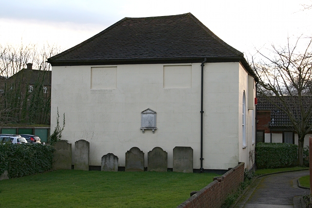
Image: © Hugh Craddock Taken: 18 Feb 2014
Side view of a former Calvinist chapel, built around 1780, by William Bugby, and later used as a Salem Baptist chapel and more recently as a synagogue. Now converted for office use. Grade II listed. To the east, in the foreground, is the burial ground, with a number of headstones laid against the east wall of the chapel. http://en.wikipedia.org/wiki/Bugby_Chapel
Images are licensed for reuse under creativecommons.org/licenses/by-sa/2.0
Image Location
Latitude
51.335316
Longitude
-0.261393