Welsh St Donats Parish Church and churchyard in the 1970s
Introduction
The photograph on this page of Welsh St Donats Parish Church and churchyard in the 1970s by eswales as part of the Geograph project.
The Geograph project started in 2005 with the aim of publishing, organising and preserving representative images for every square kilometre of Great Britain, Ireland and the Isle of Man.

There are currently over 7.5m images from over 14,400 individuals and you can help contribute to the project by visiting https://www.geograph.org.uk
Welsh St Donats Parish Church and churchyard in the 1970s
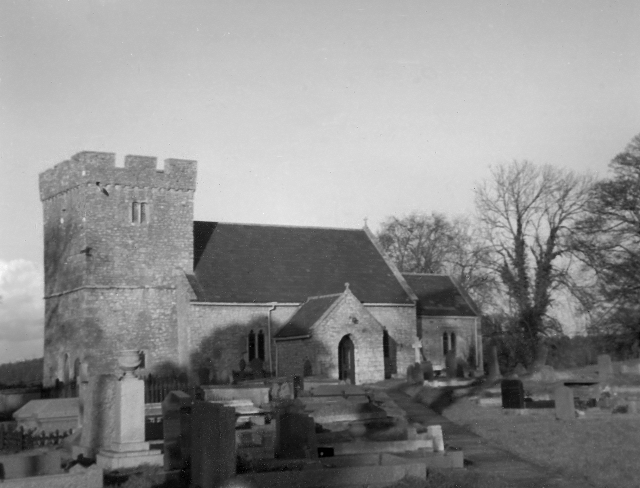
Image: © eswales Taken: Unknown
The Parish Church, which is also known as the Church of St Donat, is seen here in a photograph from c. 1975. The church is a grade I listed building, and was listed in January 1963. An internet source (East Vale Group at http://www.eastvalechurches.org.uk/ChurchWelshStDonats.html ) describes the church’s ‘arched brace truss roof timbers (circa 1500) and 13th century font’ as having contributed to its grade I listing. According to the Welsh St Donats Community Website (at http://www.welsh-st-donats-community.btck.co.uk/ ), the church ‘has been a place of worship for over 800 years’.
Images are licensed for reuse under creativecommons.org/licenses/by-sa/2.0
Image Location
Latitude
51.476954
Longitude
-3.401139