Former Route of Nidd Valley Light Railway
Introduction
The photograph on this page of Former Route of Nidd Valley Light Railway by Chris Heaton as part of the Geograph project.
The Geograph project started in 2005 with the aim of publishing, organising and preserving representative images for every square kilometre of Great Britain, Ireland and the Isle of Man.

There are currently over 7.5m images from over 14,400 individuals and you can help contribute to the project by visiting https://www.geograph.org.uk
Former Route of Nidd Valley Light Railway
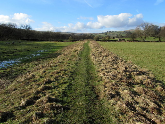
Image: © Chris Heaton Taken: 16 Feb 2014
Now adopted by the Nidderdale Way long distance footpath - this clearly shows part of the course that the railway used to follow between Pateley Bridge and Scar House Reservoir. It was mainly used for transporting equipment and men to build the two huge stone dams at the top of the dale, but also did carry some passenger traffic. It was closed and dismantled after completion of the project.
Images are licensed for reuse under creativecommons.org/licenses/by-sa/2.0
Image Location


Leaflet Map data © OpenStreetMap
Latitude
54.150101
Longitude
-1.835379