Former school, Salford and the Mary Agate village hall
Introduction
The photograph on this page of Former school, Salford and the Mary Agate village hall by Bikeboy as part of the Geograph project.
The Geograph project started in 2005 with the aim of publishing, organising and preserving representative images for every square kilometre of Great Britain, Ireland and the Isle of Man.

There are currently over 7.5m images from over 14,400 individuals and you can help contribute to the project by visiting https://www.geograph.org.uk
Former school, Salford and the Mary Agate village hall
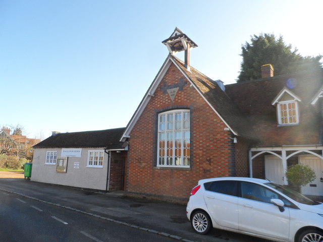
Image: © Bikeboy Taken: 16 Feb 2014
The year stone on the gable of the school says 1867. See http://www.bedfordshire.gov.uk/CommunityAndLiving/ArchivesAndRecordOffice/CommunityArchives/Salford/SalfordSchool.aspx for more information about the history of the school. The building is now a private dwelling. The Mary Agate Hall is still used for community functions.
Images are licensed for reuse under creativecommons.org/licenses/by-sa/2.0
Image Location
Latitude
52.043302
Longitude
-0.636385