Stourbridge Cricket Club, War Memorial Athletic Ground, Amblecote, Stourbridge
Introduction
The photograph on this page of Stourbridge Cricket Club, War Memorial Athletic Ground, Amblecote, Stourbridge by Terry Robinson as part of the Geograph project.
The Geograph project started in 2005 with the aim of publishing, organising and preserving representative images for every square kilometre of Great Britain, Ireland and the Isle of Man.

There are currently over 7.5m images from over 14,400 individuals and you can help contribute to the project by visiting https://www.geograph.org.uk
Stourbridge Cricket Club, War Memorial Athletic Ground, Amblecote, Stourbridge
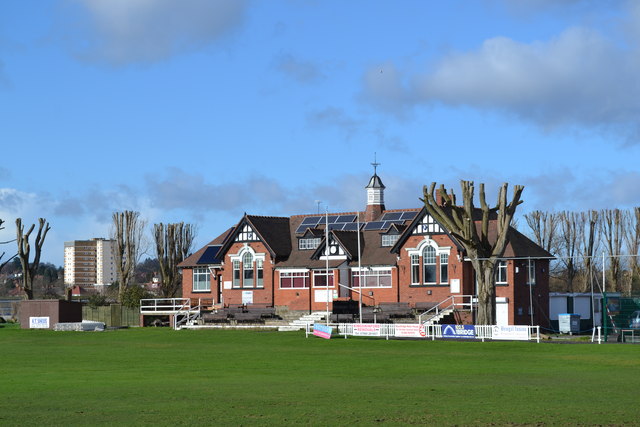
Image: © Terry Robinson Taken: 13 Feb 2014
The Cricket Club was established in 1842 and currently its first eleven play in the Birmingham District League. Between 1905 and 1981, the ground was used periodically as a venue for Worcestershire County Cricket Club The War Memorial Athletic Ground is also home to Stourbridge Football Club … aka The Glassboys in recognition of the Crystal Glass Factories in the vicinity. For more information and links to views of the Football Club … see … Image The Tower Block to the left is located on Frimstone Street For more views of the Cricket Ground … see … Image Image Image Image Image Image Image
Images are licensed for reuse under creativecommons.org/licenses/by-sa/2.0
Image Location
Latitude
52.463206
Longitude
-2.152145