Redhill, NG5, Notts.
Introduction
The photograph on this page of Redhill, NG5, Notts. by David Hallam-Jones as part of the Geograph project.
The Geograph project started in 2005 with the aim of publishing, organising and preserving representative images for every square kilometre of Great Britain, Ireland and the Isle of Man.

There are currently over 7.5m images from over 14,400 individuals and you can help contribute to the project by visiting https://www.geograph.org.uk
Redhill, NG5, Notts.
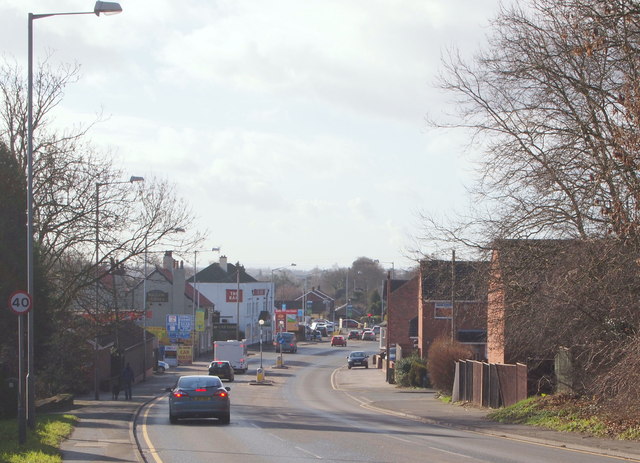
Image: © David Hallam-Jones Taken: 16 Feb 2014
This is the view of Redhill that motorists first see having descended the A60 from the Mansfield direction, i.e. down Arch Hill, with Lodge Close, the first residential street on the right immediately beyond the wind-battered wooden fence. On the left are two well-established pubs, The Waggon & Horses - nearest to the camera - and The Ram Inn. An old farm house at the foot of Red Hill is said to have been a post house where horses could be changed and guides hired by travellers for the journey through Sherwood Forest on the London-York route. Later on it became a coaching inn named The Waggon & Horses.
Images are licensed for reuse under creativecommons.org/licenses/by-sa/2.0
Image Location
Latitude
53.013449
Longitude
-1.132478