View from the top of Shaw Street, Colne, Lancashire
Introduction
The photograph on this page of View from the top of Shaw Street, Colne, Lancashire by Dr Neil Clifton as part of the Geograph project.
The Geograph project started in 2005 with the aim of publishing, organising and preserving representative images for every square kilometre of Great Britain, Ireland and the Isle of Man.

There are currently over 7.5m images from over 14,400 individuals and you can help contribute to the project by visiting https://www.geograph.org.uk
View from the top of Shaw Street, Colne, Lancashire
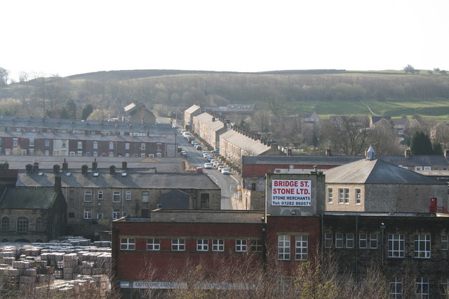
Image: © Dr Neil Clifton Taken: 1 Apr 2007
Almost everything visible in the photograph is contained within the relevant gridsquare. The terrace houses rising steeply in the morning sunlight are in Knotts Lane, which leads over to some very attractive moorland countryside, while the houses broadside on to the left are in Green Road, and further behind, Nicholas Street.
Images are licensed for reuse under creativecommons.org/licenses/by-sa/2.0
Image Location


Leaflet Map data © OpenStreetMap
Latitude
53.853037
Longitude
-2.179191