The Humber estuary from the air
Introduction
The photograph on this page of The Humber estuary from the air by Thomas Nugent as part of the Geograph project.
The Geograph project started in 2005 with the aim of publishing, organising and preserving representative images for every square kilometre of Great Britain, Ireland and the Isle of Man.

There are currently over 7.5m images from over 14,400 individuals and you can help contribute to the project by visiting https://www.geograph.org.uk
The Humber estuary from the air
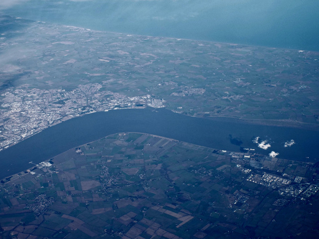
Image: © Thomas Nugent Taken: 10 Feb 2014
Two former RAF airfields can be seen this side of the river. The brown V shape below the bend in the river is the former RAF Goxhill https://en.wikipedia.org/wiki/RAF_Goxhill . Former RAF North Killingholms https://en.wikipedia.org/wiki/RAF_North_Killingholme can be seen nearer the oil tanks, towards the lower right corner. Barrow Upon Humber and the Immingham oil refineries are also visible this side of the Humber. Kingston Upon Hull is on the opposite bank, with the North Sea visible beyond the coast.
Images are licensed for reuse under creativecommons.org/licenses/by-sa/2.0
Image Location
Latitude
53.669306
Longitude
-0.328935