Westfield Bridge
Introduction
The photograph on this page of Westfield Bridge by Symon Parsley as part of the Geograph project.
The Geograph project started in 2005 with the aim of publishing, organising and preserving representative images for every square kilometre of Great Britain, Ireland and the Isle of Man.

There are currently over 7.5m images from over 14,400 individuals and you can help contribute to the project by visiting https://www.geograph.org.uk
Westfield Bridge
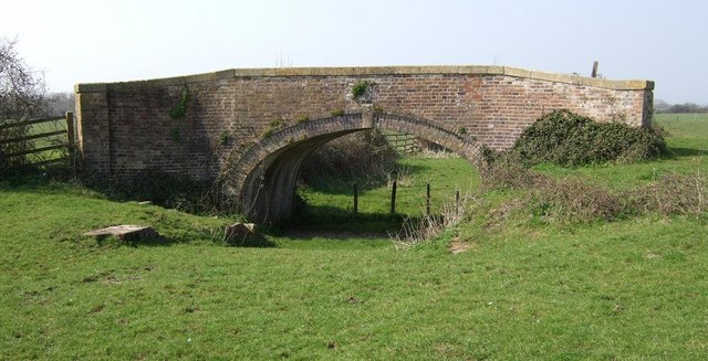
Image: © Symon Parsley Taken: 1 Apr 2007
An occupation bridge over an infilled section of the Stroudwater Canal. Just in front of the bridge you can see the remains of the Westfield Lock which was blown up during the building of the nearby M5. The keystone reads 1841.
Images are licensed for reuse under creativecommons.org/licenses/by-sa/2.0
Image Location
Latitude
51.754054
Longitude
-2.320112