Lenton Firs Lodge
Introduction
The photograph on this page of Lenton Firs Lodge by Alan Murray-Rust as part of the Geograph project.
The Geograph project started in 2005 with the aim of publishing, organising and preserving representative images for every square kilometre of Great Britain, Ireland and the Isle of Man.

There are currently over 7.5m images from over 14,400 individuals and you can help contribute to the project by visiting https://www.geograph.org.uk
Lenton Firs Lodge
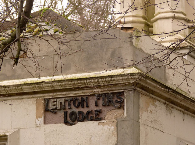
Image: © Alan Murray-Rust Taken: 9 Feb 2014
Inscribed name panel on the Derby Road façade. The lettering appears to have been rather crudely restored.
Images are licensed for reuse under creativecommons.org/licenses/by-sa/2.0
Image Location
Latitude
52.94459
Longitude
-1.196508