Delph Hill Road from junction with Spring Terrace
Introduction
The photograph on this page of Delph Hill Road from junction with Spring Terrace by Michael Steele as part of the Geograph project.
The Geograph project started in 2005 with the aim of publishing, organising and preserving representative images for every square kilometre of Great Britain, Ireland and the Isle of Man.

There are currently over 7.5m images from over 14,400 individuals and you can help contribute to the project by visiting https://www.geograph.org.uk
Delph Hill Road from junction with Spring Terrace
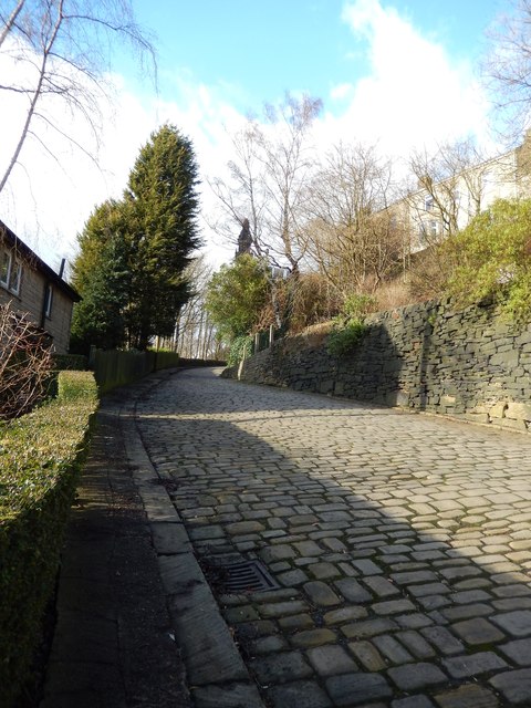
Image: © Michael Steele Taken: 2 Feb 2014
'Delph' means quarry. The land over which the road was constructed was owned by John Edward Wainhouse, whose famous tower can be seen in the centre background. The wall on the right is a 'Judd' wall constructed of quarry waste, and there is evidence of quarrying having occurred to the left.
Images are licensed for reuse under creativecommons.org/licenses/by-sa/2.0
Image Location
Latitude
53.711283
Longitude
-1.881334