Two eras of defence at Parker's Corner
Introduction
The photograph on this page of Two eras of defence at Parker's Corner by Robin Webster as part of the Geograph project.
The Geograph project started in 2005 with the aim of publishing, organising and preserving representative images for every square kilometre of Great Britain, Ireland and the Isle of Man.

There are currently over 7.5m images from over 14,400 individuals and you can help contribute to the project by visiting https://www.geograph.org.uk
Two eras of defence at Parker's Corner
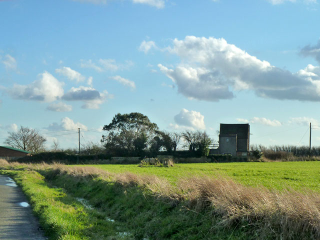
Image: © Robin Webster Taken: 7 Feb 2014
The house, currently named 'Humblebee', was an observation post in WWII, which presumably accounts for the strange looking extension on the north (near) side with a high level circular window. Nearer, in the field, is an underground nuclear observation bunker from the cold war era. Its access shaft is reportedly now blocked with rubble.
Images are licensed for reuse under creativecommons.org/licenses/by-sa/2.0
Image Location


Leaflet Map data © OpenStreetMap
Latitude
51.468322
Longitude
0.636916