Route of new Water Main
Introduction
The photograph on this page of Route of new Water Main by Ian Capper as part of the Geograph project.
The Geograph project started in 2005 with the aim of publishing, organising and preserving representative images for every square kilometre of Great Britain, Ireland and the Isle of Man.

There are currently over 7.5m images from over 14,400 individuals and you can help contribute to the project by visiting https://www.geograph.org.uk
Route of new Water Main
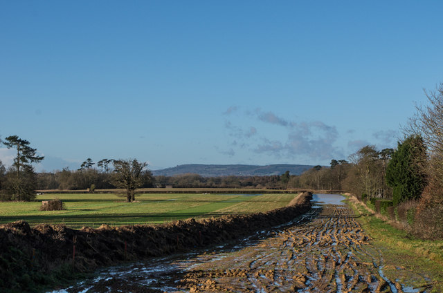
Image: © Ian Capper Taken: 1 Feb 2014
During 2013, Sutton and East Surrey Water have been laying a new 17km main connecting their pumping stations at Outwood and Buckland in a £14m project. This is part of the route off Dovers Green Road. In the background is an area of flooding, following the wettest January on record in southern England. In the far distance is Leith Hill and on the left are two pillboxes, examples of many that are situated along the route of the River Mole.
Images are licensed for reuse under creativecommons.org/licenses/by-sa/2.0
Image Location
Latitude
51.213385
Longitude
-0.203119