Freight track past the former Aberdare (High Level) railway station
Introduction
The photograph on this page of Freight track past the former Aberdare (High Level) railway station by Jaggery as part of the Geograph project.
The Geograph project started in 2005 with the aim of publishing, organising and preserving representative images for every square kilometre of Great Britain, Ireland and the Isle of Man.

There are currently over 7.5m images from over 14,400 individuals and you can help contribute to the project by visiting https://www.geograph.org.uk
Freight track past the former Aberdare (High Level) railway station
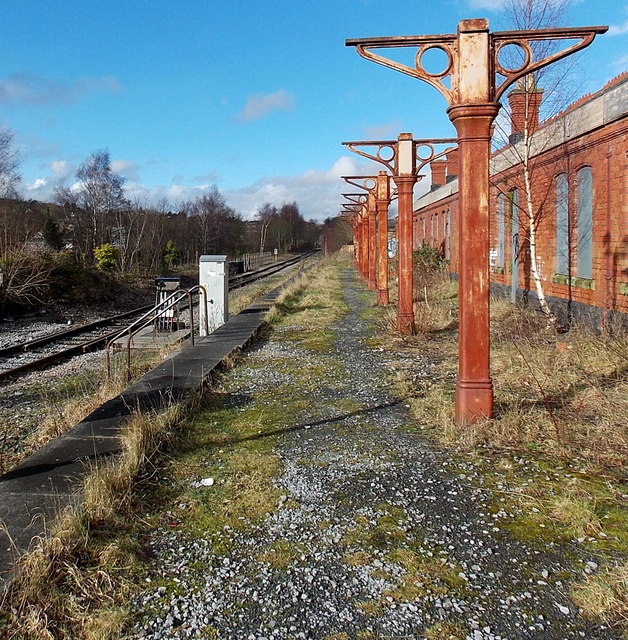
Image: © Jaggery Taken: 4 Feb 2014
Currently (early 2014) for freight only, the track alongside the former station http://www.geograph.org.uk/photo/3840712 continues to Hirwaun about 7km away. It was announced in March 2011 that the Welsh Assembly Government's 2011-2012 capital programme would include the reopening of this line for passenger services as part of the Cynon Valley Scheme. However, there was no sign of any such work in progress nearby.
Images are licensed for reuse under creativecommons.org/licenses/by-sa/2.0
Image Location
Latitude
51.715587
Longitude
-3.443824