Former Aberdare (High Level) railway station
Introduction
The photograph on this page of Former Aberdare (High Level) railway station by Jaggery as part of the Geograph project.
The Geograph project started in 2005 with the aim of publishing, organising and preserving representative images for every square kilometre of Great Britain, Ireland and the Isle of Man.

There are currently over 7.5m images from over 14,400 individuals and you can help contribute to the project by visiting https://www.geograph.org.uk
Former Aberdare (High Level) railway station
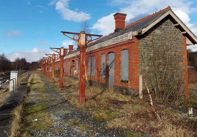
Image: © Jaggery Taken: 4 Feb 2014
Located NW of the present-day (2014) station. http://www.geograph.org.uk/photo/3839105 The metal posts and frames used to support the canopy seen in this http://www.geograph.org.uk/photo/3305926 view taken in 2000.
Images are licensed for reuse under creativecommons.org/licenses/by-sa/2.0
Image Location
Latitude
51.715502
Longitude
-3.443387