Nottingham Canal from Moor Lane Bridge
Introduction
The photograph on this page of Nottingham Canal from Moor Lane Bridge by Richard Bird as part of the Geograph project.
The Geograph project started in 2005 with the aim of publishing, organising and preserving representative images for every square kilometre of Great Britain, Ireland and the Isle of Man.

There are currently over 7.5m images from over 14,400 individuals and you can help contribute to the project by visiting https://www.geograph.org.uk
Nottingham Canal from Moor Lane Bridge
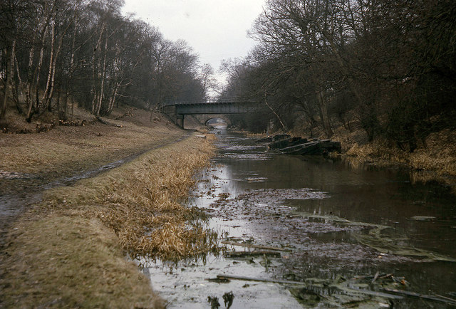
Image: © Richard Bird Taken: 10 Mar 1963
In March 1963, the canal still held water here, although it was now in a very sorry state; a sunken barge reposes near the bank although some attempt has been made to tidy up the area with recent tree and shrub trimming on the right (north) bank. The archetypal March grey day does nothing to lift the scene of total dereliction. All traffic ceased here in about 1936.
Images are licensed for reuse under creativecommons.org/licenses/by-sa/2.0
Image Location
Latitude
52.949781
Longitude
-1.247909