Lower Brockhurst Farm
Introduction
The photograph on this page of Lower Brockhurst Farm by John M as part of the Geograph project.
The Geograph project started in 2005 with the aim of publishing, organising and preserving representative images for every square kilometre of Great Britain, Ireland and the Isle of Man.

There are currently over 7.5m images from over 14,400 individuals and you can help contribute to the project by visiting https://www.geograph.org.uk
Lower Brockhurst Farm
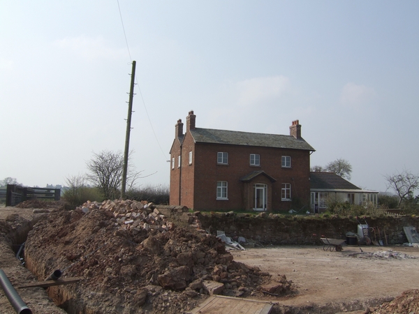
Image: © John M Taken: 31 Mar 2007
The building site in front of the farmhouse is for drainage works and a car park for the barn conversion.
Images are licensed for reuse under creativecommons.org/licenses/by-sa/2.0
Image Location


Leaflet Map data © OpenStreetMap
Latitude
52.709514
Longitude
-2.261792