The Royal Military Canal at Appledore
Introduction
The photograph on this page of The Royal Military Canal at Appledore by Marathon as part of the Geograph project.
The Geograph project started in 2005 with the aim of publishing, organising and preserving representative images for every square kilometre of Great Britain, Ireland and the Isle of Man.

There are currently over 7.5m images from over 14,400 individuals and you can help contribute to the project by visiting https://www.geograph.org.uk
The Royal Military Canal at Appledore
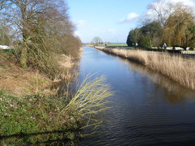
Image: © Marathon Taken: 2 Feb 2014
The Royal Military Canal was built between 1804 and 1809 as a response to the threat of a Napoleonic invasion. At its peak there were 1,500 men working on the canal. The canal was dug entirely by hand, using picks and shovels and the soil was carried away in wheelbarrows. It runs for 28 miles between Seabrook near Folkestone and Cliff End near Hastings, and follows the old cliff line bordering Romney Marsh. Although it was never called into action, the canal was fortified with concrete pillboxes during the early stages of the Second World War, when a German invasion was looking likely. Its other original purpose was to act as a major drainage system for the winter, and a reservoir for the summer and so greatly improve conditions on Romney Marsh. It still does this today. This is the view at Appledore. The Royal Military Canal Path follows the left hand bank here. The road on the right hand side is called Rhee Wall.
Images are licensed for reuse under creativecommons.org/licenses/by-sa/2.0
Image Location


Leaflet Map data © OpenStreetMap
Latitude
51.028889
Longitude
0.791317