Thamesmead: Gallions Canal
Introduction
The photograph on this page of Thamesmead: Gallions Canal by Nigel Cox as part of the Geograph project.
The Geograph project started in 2005 with the aim of publishing, organising and preserving representative images for every square kilometre of Great Britain, Ireland and the Isle of Man.

There are currently over 7.5m images from over 14,400 individuals and you can help contribute to the project by visiting https://www.geograph.org.uk
Thamesmead: Gallions Canal
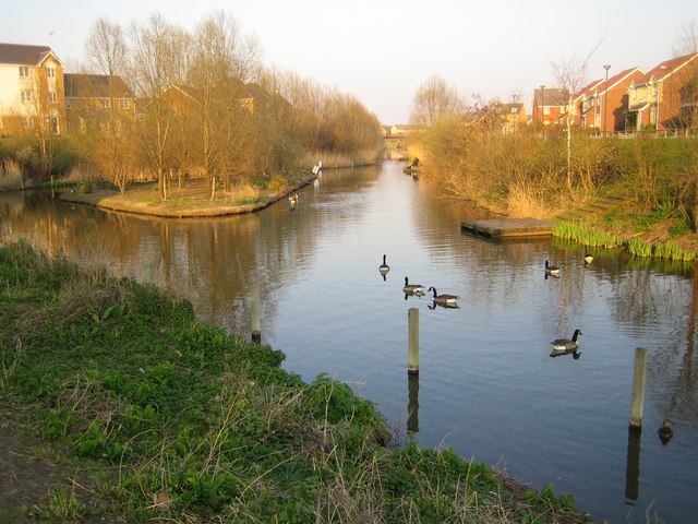
Image: © Nigel Cox Taken: 26 Mar 2007
Large parts of Thamesmead are on land originally contaminated by the activities of the former Woolwich Royal Arsenal. The land was first recovered by the GLC for residential use in the 1960s. As part of this redevelopment a system of canals and lakes were built in order to store and manage surface water run-off prior to its discharge into the River Thames. As part of the current development Tilfen Land Limited have retained and rebuilt sections of the old system, again to manage surface water run-off, including the provision of flood storage areas, but also to provide an ecology corridor and a public amenity through the residential areas. There is a .pdf file describing the scheme on Tilfen's website here http://www.tilfenland.co.uk/pdf/reshapingenvironments.pdf This image was taken from the east side of Delisle Road with New Acres Road on the right. It is difficult to categorize the photo on the Geograph site in the sense that it is not an old navigable canal, nor a river, but an artificial drainage cut. "Drain" in the sense of a fenland drain therefore seems most suitable.
Images are licensed for reuse under creativecommons.org/licenses/by-sa/2.0
Image Location
Latitude
51.500294
Longitude
0.090499