Burst Banks of River Chelmer
Introduction
The photograph on this page of Burst Banks of River Chelmer by Essex Walks as part of the Geograph project.
The Geograph project started in 2005 with the aim of publishing, organising and preserving representative images for every square kilometre of Great Britain, Ireland and the Isle of Man.

There are currently over 7.5m images from over 14,400 individuals and you can help contribute to the project by visiting https://www.geograph.org.uk
Burst Banks of River Chelmer
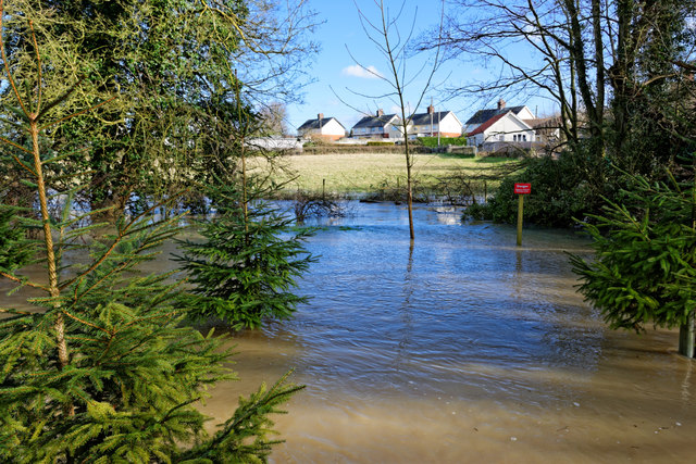
Image: © Essex Walks Taken: 1 Feb 2014
Flood waters to the east of St Mary's, Church End, Great Dunmow, Essex on 1st Feb 2014. A sign was pointing in the direction of this shot saying "Riverside Walk". Part of a walk route at http://www.essexwalks.com/walks/stebbing.html
Images are licensed for reuse under creativecommons.org/licenses/by-sa/2.0
Image Location
Latitude
51.881284
Longitude
0.367059